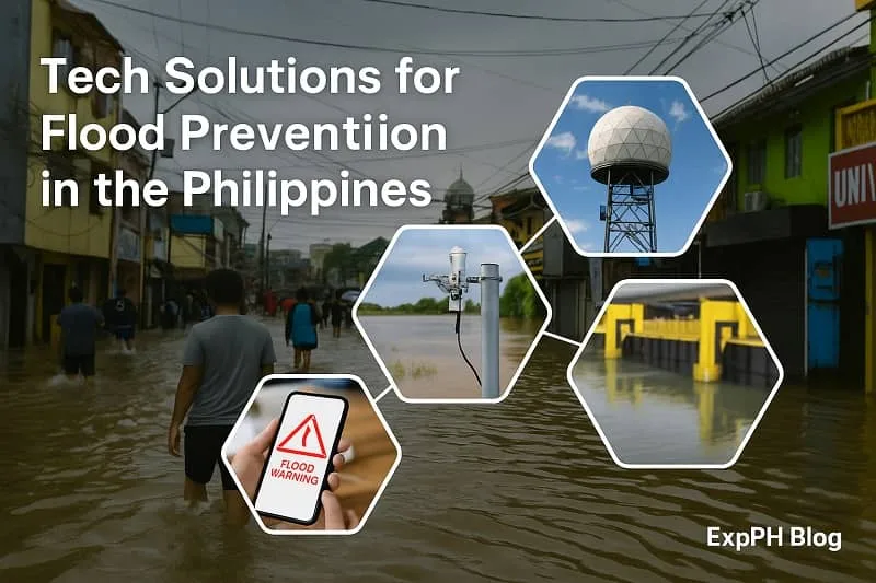
Tech Solutions for Flood Prevention in the Philippines
Philippine Government Prevents Flooding Through Technology: Flooding is one of the most persistent natural disasters in the Philippines, causing both short-term destruction and long-term economic setbacks. Every year, millions of Filipinos are affected by flash floods, overflowing rivers, and storm surges that inundate homes, roads, and businesses. With its archipelagic geography and tropical climate, the country is uniquely vulnerable: located in the Pacific typhoon belt, the Philippines faces an average of 20 tropical cyclones annually, according to the Philippine Atmospheric, Geophysical and Astronomical Services Administration (PAGASA). Many of these cyclones bring torrential rains that trigger severe flooding, particularly in low-lying urban centers like Metro Manila, Cebu, and Davao.
The human and economic toll of floods is staggering. Billions of pesos are lost annually due to property damage, destroyed crops, disrupted transportation, and displaced communities. More importantly, floods threaten human lives, particularly in poor and densely populated areas where drainage infrastructure is weak. The increasing effects of climate change stronger typhoons, heavier rains, and rising sea levels make flood prevention a national priority.
To address this urgent problem, the Philippine Government Prevents Flooding Through Technology by adopting modern tools such as forecasting systems, smart flood-control infrastructure, GIS-based hazard mapping, and advanced communication strategies. These innovations allow for quicker response, better preparedness, and long-term resilience. Instead of depending solely on traditional flood defenses like sandbags and dikes, the government is now relying on science-driven solutions from Doppler weather radars to underground rainwater reservoirs, from real-time river sensors to community-driven mobile apps.
This long-form article explores in detail how the Philippine Government Prevents Flooding Through Technology, examining the systems in place, the innovations being deployed, and the challenges that remain. By understanding these technological strategies, we can better appreciate how the Philippines is building a safer and more resilient future.
Flood prevention is just one example of how innovation creates real change. Discover how digital tools and solutions are improving lives across education, healthcare, jobs, and communities.
Read more: Technology for Social Impact in the Philippines
Table of Contents
1. Flood Forecasting and Monitoring Systems
One of the cornerstones of how the Philippine Government Prevents Flooding Through Technology is its investment in flood forecasting and monitoring systems. Accurate and timely information about rainfall and water levels gives communities valuable hours or even days to prepare before disaster strikes.
Rainfall and Water-Level Sensors
Across the country, rainfall and water-level sensors are installed in rivers, dams, and creeks. These devices measure the intensity of rainfall and detect rising water levels in real time. The information they collect is transmitted to central monitoring stations operated by PAGASA and the Department of Science and Technology (DOST). For example, in flood-prone regions such as Pampanga, Bulacan, and Cagayan Valley, these sensors play a critical role in predicting when rivers are likely to overflow.
By integrating these systems with local disaster risk reduction and management offices, the government ensures that warnings reach communities quickly. This setup demonstrates clearly how the Philippine Government Prevents Flooding Through Technology, as lives can be saved and property damage minimized when evacuations are carried out earlier.
Automated Flood Early Warning Systems (AFEWS)
In addition to sensors, the Automated Flood Early Warning Systems (AFEWS) provide an immediate response mechanism. These systems automatically trigger alarms often loud sirens when water levels rise beyond a critical threshold. They are particularly effective in rural and remote areas where access to mobile phones and internet updates is limited.
For example, some communities in Isabela and Nueva Ecija rely heavily on these alarms to prepare for evacuations. The deployment of AFEWS highlights how the Philippine Government Prevents Flooding Through Technology not only in urban centers but also in vulnerable rural provinces.
Doppler Weather Radars and Satellites
Another crucial technological asset is the network of Doppler weather radars operated by PAGASA. These radars track raincloud movements, measure rainfall intensity, and forecast typhoon paths. Combined with satellite imagery, they provide real-time updates that can predict which regions are most at risk.
This system has already proven its effectiveness during major typhoons such as Yolanda (Haiyan) and Ulysses, where early warnings allowed for pre-emptive evacuations. Sharing this data with the National Disaster Risk Reduction and Management Council (NDRRMC) shows how the Philippine Government Prevents Flooding Through Technology by connecting scientific forecasting directly with disaster response.
Impact: Flood forecasting and monitoring reduce casualties, prevent large-scale property damage, and allow better allocation of emergency resources. This integration of science into public safety is one of the most vital ways the Philippine Government Prevents Flooding Through Technology.
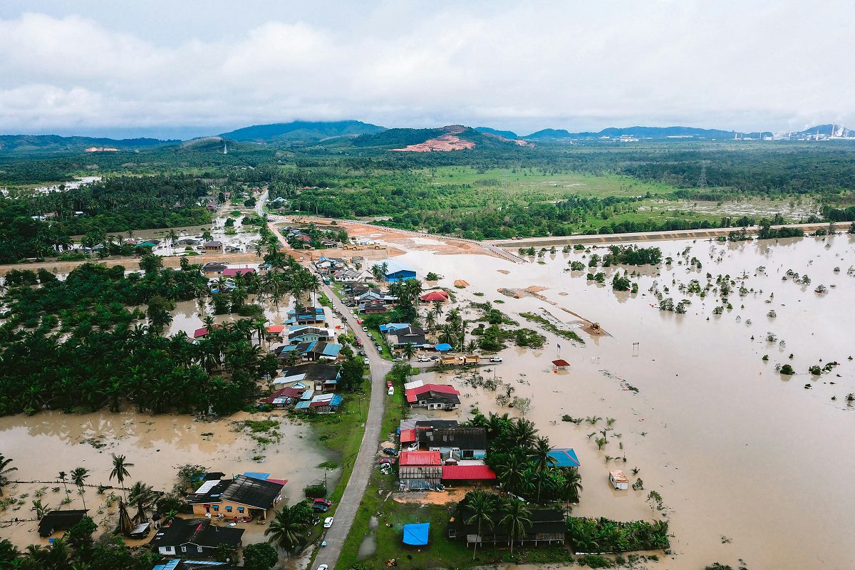
Severe flooding affects a rural village, submerging homes and farmland after continuous heavy rains
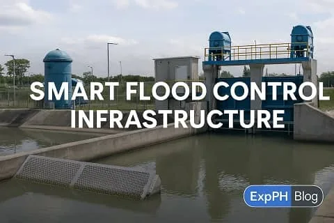
2. Smart Flood Control Infrastructure
Forecasting alone is not enough; floodwaters must also be managed physically. Another key strategy in how the Philippine Government Prevents Flooding Through Technology is through smart flood-control infrastructure, which combines engineering with automation.
Pumping Stations and Flood Gates
The Metropolitan Manila Development Authority (MMDA) operates over 50 pumping stations across Metro Manila. These facilities pump rainwater out of low-lying areas and redirect it into rivers or Manila Bay. Many of them are now equipped with remote monitoring systems and automatic controls, which activate when rainfall reaches dangerous levels.
Flood gates, meanwhile, regulate the flow of rivers and canals, preventing water from spilling into residential areas. These structures show how the Philippine Government Prevents Flooding Through Technology by blending traditional flood control with modern automation.
Underground Floodwater Reservoirs
A more recent innovation is the construction of underground floodwater reservoirs or detention tanks. For example, the Bonifacio Global City (BGC) catch basin can store up to 32 million liters of stormwater, while the University of Santo Tomas (UST) flood detention tank prevents chronic flooding in Sampaloc, Manila.
These underground tanks demonstrate urban engineering at its best hiding massive storage systems below busy streets and universities. Such projects clearly show how the Philippine Government Prevents Flooding Through Technology by rethinking how cities handle excess rainfall.
River Dredging and Desilting Machines
In addition to new infrastructure, maintenance of waterways is critical. The government deploys modern dredgers and desilting machines to clear clogged rivers and estuaries. By removing silt, garbage, and debris, these machines increase the water-carrying capacity of rivers, reducing the risk of overflow.
Impact: These infrastructure projects demonstrate how the Philippine Government Prevents Flooding Through Technology by investing in long-term, large-scale solutions that reduce flood risks in high-density areas like Metro Manila and Cebu.
Department of Science and Technology (DOST) – Leads technological innovations for disaster resilience.
Affordable Flood Mitigation Tools for Households
While large-scale pumping stations and flood gates are managed by the government, households can also reduce flood damage through practical, technology-assisted tools. Simple devices such as portable water pumps, flood barriers, and waterproof storage solutions help manage minor flooding and protect valuables during heavy rains. These tools do not replace government infrastructure, but they provide an added layer of preparedness, especially in low-lying residential areas where floodwater can accumulate quickly.
For families looking to prepare their homes ahead of the rainy season, essential flood-mitigation equipment such as portable water pumps and water-resistant storage containers are widely available through trusted local marketplaces like Shopee Philippine. Having these tools ready can make recovery faster and reduce losses during sudden flooding events.
https://shopee.ph

3. GIS Mapping and Hazard Simulation
Technology also plays a vital role in planning cities that are resilient to floods. Through Geographic Information Systems (GIS), LiDAR technology, and simulation models, the Philippine Government Prevents Flooding Through Technology by mapping risks before they become disasters.
Geographic Information Systems (GIS)
GIS technology integrates data on rainfall, elevation, soil, and land use to identify flood-prone zones. Local government units (LGUs) use this information for urban planning, zoning, and drainage projects. For example, GIS maps help LGUs decide where not to build housing projects and where to prioritize drainage improvements.
LiDAR Technology and Hazard Mapping
Light Detection and Ranging (LiDAR) technology creates precise 3D maps of landscapes. These maps allow engineers to model how floodwaters will flow across different terrains. Cities like Iloilo and Davao have already used LiDAR data for smart urban planning, ensuring that new developments do not block natural waterways.
Simulation Models for Preparedness
Computer simulations project the impact of heavy rainfall or typhoon events. For instance, the Pasig-Marikina River rehabilitation plan was designed using such simulations. These models highlight how the Philippine Government Prevents Flooding Through Technology by preparing for “what if” scenarios long before they happen.
Impact: Hazard mapping and simulations ensure smarter city design, preventing the construction of vulnerable communities in high-risk zones.
Early Warning and Communication Technology
Even with the best infrastructure, floods can still happen. Thus, effective communication systems are critical in minimizing harm. The Philippine Government Prevents Flooding Through Technology by ensuring early warnings reach people quickly.
Color-Coded Alerts
PAGASA’s color-coded alert system makes flood warnings simple to understand:
- Yellow – possible flooding
- Orange – threatening flooding
- Red – serious flooding expected
This accessible system demonstrates how the Philippine Government Prevents Flooding Through Technology by prioritizing clarity in communication.
SMS and Mobile Alerts
- Through partnerships with telecom providers, the government sends SMS alerts and cell broadcast warnings to millions of subscribers. This system provides life-saving minutes or hours for evacuation, especially in flood-prone areas.
Barangay Sirens and IoT Alarms
- At the barangay level, communities rely on sirens, loudspeakers, and IoT-based alarms that automatically trigger when sensors detect critical water levels. These localized systems highlight how the Philippine Government Prevents Flooding Through Technology even in grassroots settings.
Impact: Early warning and communication technology saves lives by ensuring that citizens receive critical information before it’s too late.
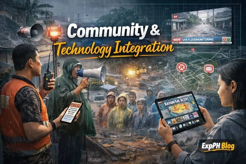
4. Community and Technology Integration
Flood prevention is not just about machines it’s also about people. The Philippine Government Prevents Flooding Through Technology by combining community involvement with advanced tools.
Community Flood Watchers
In flood-prone barangays, volunteers serve as community flood watchers. Equipped with radios, mobile apps, and monitoring devices, they report water levels to local disaster offices.
Crowdsourced Flood Reporting
Apps like “Bayanihan Alert” and social media platforms allow citizens to report flooding in real time. This crowdsourced data is then verified and incorporated into official monitoring systems.
Training and Education
Workshops, disaster drills, and education campaigns ensure citizens know how to respond when alerts are issued. This highlights another way the Philippine Government Prevents Flooding Through Technology by empowering people, not just relying on infrastructure.
Impact: Involving communities creates a culture of preparedness and strengthens national resilience.
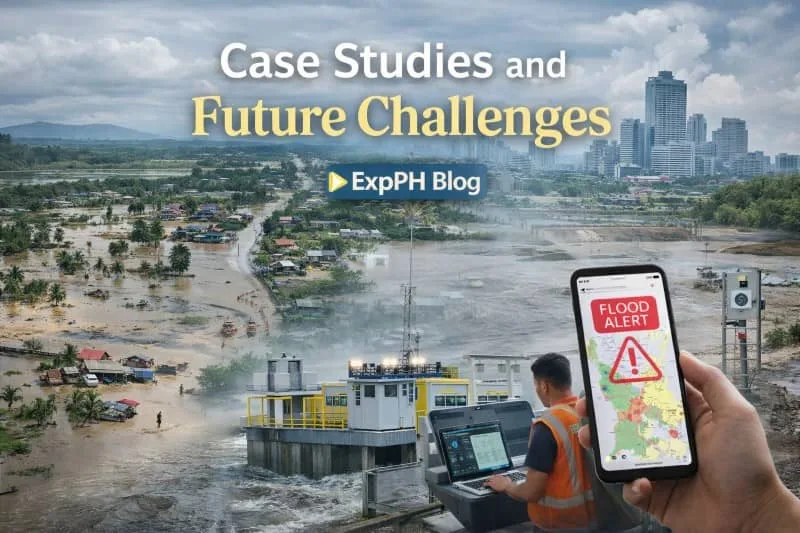
5. Case Studies and Future Challenges
Real-world examples show how the Philippine government prevents flooding using modern technology. These systems operate in major cities and vulnerable communities. They combine engineering, monitoring tools, and data-driven planning to reduce risks and improve disaster response nationwide.
Metro Manila Flood Control Plan
In Metro Manila, flood control depends on pumping stations, drainage networks, and the Flood Control Information System. These solutions manage water flow in densely populated areas. They help reduce flood impact and support faster response during heavy rains and typhoons.
Marikina River Monitoring System
The Marikina River Monitoring System uses sensors, gauges, and real-time dashboards to track water levels. Authorities can issue early warnings and organize evacuations quickly. This approach has helped save lives and reduce damage during strong typhoons.
Smart City Flood Management in Iloilo and Davao
Cities like Iloilo and Davao apply smart flood management tools such as LiDAR mapping and community reporting. These systems improve planning and awareness in expanding urban areas. They strengthen resilience and help communities prepare for extreme weather conditions.
Despite these efforts, challenges remain. Limited funding, rapid urban growth, and informal settlements continue to strain flood control systems. Climate change also increases weather unpredictability, making forecasts harder. These factors highlight the need for continuous improvement and long-term solutions.
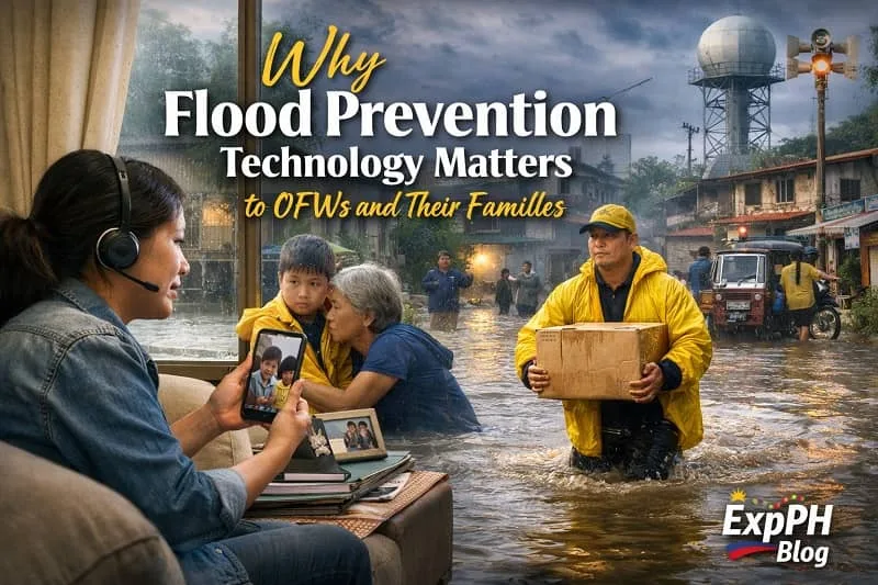
6. Why Flood Prevention Technology Matters to OFWs and Their Families
For millions of Overseas Filipino Workers, flood prevention is a personal concern. While they work abroad to support their families, many loved ones live in flood-prone areas such as Bulacan, Pampanga, Cagayan Valley, Metro Manila, and parts of Mindanao. When floods strike, OFWs face stress and unexpected expenses from afar. Early warnings from the Philippine Atmospheric, Geophysical and Astronomical Services Administration and coordinated response through the National Disaster Risk Reduction and Management Council help families evacuate safely and protect essential belongings and small businesses.
Technology-based flood prevention also protects investments funded by remittances. Many OFWs build homes, open sari-sari stores, buy farmland, or invest in rental properties. Smart infrastructure, hazard mapping, and early warning systems reduce the risk of severe damage. When the government strengthens flood control through technology, it protects the sacrifices and long-term financial goals of OFW families. Stronger resilience reduces emergency borrowing and supports steady financial growth.
OFWs abroad can monitor official PAGASA bulletins, local government updates, and SMS alerts during typhoon season. Staying informed allows them to guide their families and make timely decisions. Teaching relatives to understand alert levels and prepare emergency supplies improves safety at home. Flood prevention technology protects families, secures OFW-earned assets, and supports a safer future.
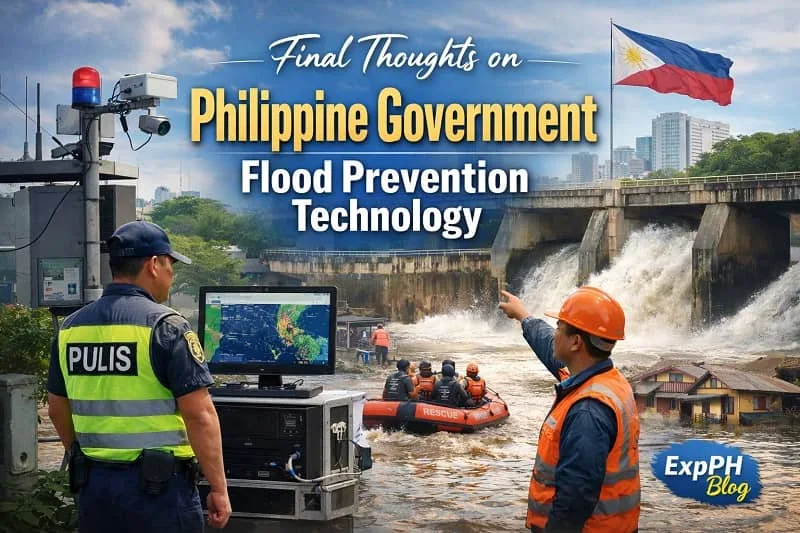
Final Thoughts on Philippine Government Flood Prevention Technology
The Philippine Government Prevents Flooding Through Technology by combining accurate forecasting systems, smart flood control infrastructure, GIS mapping, early warning tools, and active citizen participation. Technologies such as Doppler weather radars, automated pumping stations, underground flood reservoirs, and mobile alert systems allow authorities and communities to prepare earlier and respond faster. These solutions help reduce loss of life, limit property damage, and improve coordination during disasters. Flood prevention is no longer based only on physical barriers but on data, communication, and informed decision making that support both national agencies and local governments.
As climate change brings stronger typhoons and heavier rainfall, the importance of these technologies continues to grow. Long term resilience depends on sustained investment, innovation, and strong collaboration between government institutions and communities. By integrating modern technology with local knowledge and preparedness, the Philippine Government Prevents Flooding Through Technology not only to address current risks but also to create safer cities and more resilient communities for future generations.
FAQs About Tech Solutions for Flood Prevention in the Philippines
What are the main tech solutions used for flood prevention in the Philippines?
The Philippines uses sensors, Doppler radars, GIS mapping, automated flood warnings, pumping stations, and smart infrastructure to reduce flood risks nationwide.
How does the government use Doppler radars for flood forecasting?
Doppler radars track raincloud movement, rainfall intensity, and typhoon paths, giving officials early data to prepare communities before flooding occurs.
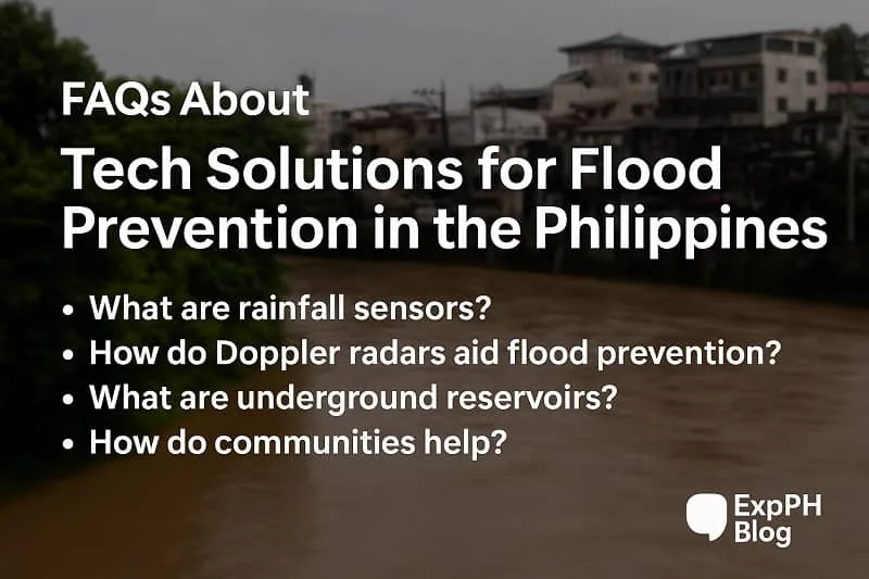
What are rainfall and water level sensors?
These sensors measure rainfall and detect rising rivers in real time. Data is sent to agencies like PAGASA and DOST to issue timely flood warnings.
How do Automated Flood Early Warning Systems help communities?
These systems activate alarms or sirens when rivers reach critical levels, providing rural and urban areas extra time to prepare or evacuate.
What smart infrastructure is used to control flooding in cities?
Smart pumping stations, automated flood gates, and underground water reservoirs help manage rainwater and prevent flooding in low lying areas.
How does GIS mapping help in flood prevention?
GIS maps show flood prone areas based on rainfall, elevation, soil type, and land use, helping LGUs plan safer communities and drainage systems.
What role does LiDAR technology play in flood management?
LiDAR creates detailed 3D maps that simulate how water flows during heavy rain, helping engineers design safer drainage and flood control projects.
How does the government warn people quickly during floods?
The government uses SMS alerts, color coded advisories, cell broadcasts, barangay sirens, and real time dashboards to warn residents immediately.
How are communities involved in tech based flood prevention?
Communities provide real time flood reports through apps, help monitor water levels, and participate in disaster training for better preparedness.
What challenges remain in using tech for flood prevention in the Philippines?
Challenges include rapid urbanization, funding limits, outdated systems in some areas, and stronger typhoons caused by climate change.
Want to Explore the Bigger Picture of Technology in the Philippines?
Flood prevention is just one part of how innovation is shaping the country. Discover how technology is driving progress, creating opportunities, and transforming industries across the Philippines.
Read more: Technology in the Philippines: Strong Progress, Key Opportunities, and Future Innovations
Visit the source website through the link below.
- Multi-Hazard Impact-Based Forecasting and Early Warning System (MH-IBF-EWS)
- Flood Forecasting and Warning System for River Basins (PAGASA)
- HazardHunterPH Flood Hazard Map Tools
- PAGASA Flood Information and Bulletins
Learning Hub Quiz!
Test your knowledge about how technology helps prevent flooding in the Philippines.
Results


#1. Which tool tracks raincloud movement?
#2. What do water sensors detect?
#3. What system triggers flood alarms?
#4. Which agency runs radars?
#5. What helps pump floodwater?
#6. What stores excess rainwater?
#7. What creates 3D terrain maps?
#8. How do alerts reach people fast?
#9. Which group sends real time reports?
#10. What mapping tool identifies risks?
Your curiosity supports better learning for all Filipinos.
Please comment your quiz experience with us on ExpPH Blog to help others learn too!

A Filipino web developer with a background in Computer Engineering. Founder of ExpPH Blog and ExpPH Business Guide, creating practical content on OFW guidance, business, finance, freelancing, travel, and lifestyle. Passionate about helping Filipinos grow, he shares insights that educate, empower, and inspire readers nationwide.